All Church of England burial ground records will be available to search within five years under an ambitious new laser-scanning survey scheme.
Records of the burial grounds for two West Yorkshire churches – All Hallows’ Church in Kirkburton and Emmanuel Church in Shelley – are now available online, and the Church plans to survey all 15,000 burial grounds by 2025.
Nick Edmonds, the Church of England’s senior media officer, said: “It’s a system that has potential for enormous growth and future usage.
“It can help people with their family history and accessing burial grounds that they didn’t know about before."
Staff from surveying company Atlantic Geomatics surveyed the graveyard space using a laser and camera.
This produces a more accurate record of the churchyards than conventional written records.
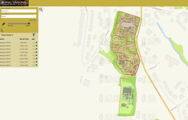
The free online databases for each churchyard show a detailed map.
Researchers can browse the map and search for names.
Each burial record includes the name of the deceased, their burial date, their age at death and a photograph of the grave.

The new online map of All Hallows' churchyard in Kirkburton, Yorkshire
The Church is now in the process of securing several million pounds in funding to carry out in-depth surveys of all its burial grounds and make the databases available via the online Church Heritage Record.
Dr Joseph Elders, Head of Church Building Strategy at the Church of England, said the project would uncover “all sorts of records” besides family history records, including supporting social history research.
He said that the survey of the All Hallows' churchyard revealed that half of all the burials there were for children under two, revealing the shocking extent of infant mortality at the time.
However, he added the finished results would also be very useful to “anyone looking at their heritage”.
The Church also hopes to work with other denominations and religions in the UK to create similar maps of their burial grounds.
The Church will provide £250,000 towards the project and has received the same amount from Historic England, which has also provided spatial data records to support the project.
The basic databases will be available for free, although the companies carrying out the surveys may charge for mediation of the data.
The scanning also has ecological benefits, by measuring the growth of trees and plants in the graveyards.
It will also help church authorities identify where empty space is available for new burials.
The data will be shared with Historic England, Natural England and the National Biodiversity Network.
Rosemary Collins is the staff writer of Who Do You Think You Are? Magazine

